SnowSat GIS Data Manager
Geodata easily updating and managing
Revised design, intuitive user guidance - with the SnowSat GIS Data Manager, managing geodata has never been easier.
Whether slope grooming, snowmaking or management is the issue – the SnowSat GIS Data Manager is an indispensable tool for the entire team. Geospatial data can be managed and updated easily in this software. The result is a perfect, comprehensive map of the ski area that everyone can work with. And thus uniform knowledge base for all.
It has never been this easy – Adapting and managing GIS data
The geographic information system (GIS for short) of a ski area includes all spatial data relevant to everyday work: profile of the terrain, slope edges, positions of the snow guns, areas to be covered with machine-made snow, anchor points for winch cats, roads, buildings and much more. This GIS data serves as the basis for all business cases (construction activity, creation of snowmaking and grooming plans or statistics) in the ski area. In the past, a surveying company had to be commissioned to manage this data. Thanks to the GIS Data Manager the employees in the ski area are now able to update this data on their own quite flexibly according to the conditions.
How the SnowSat GIS Data Manager works
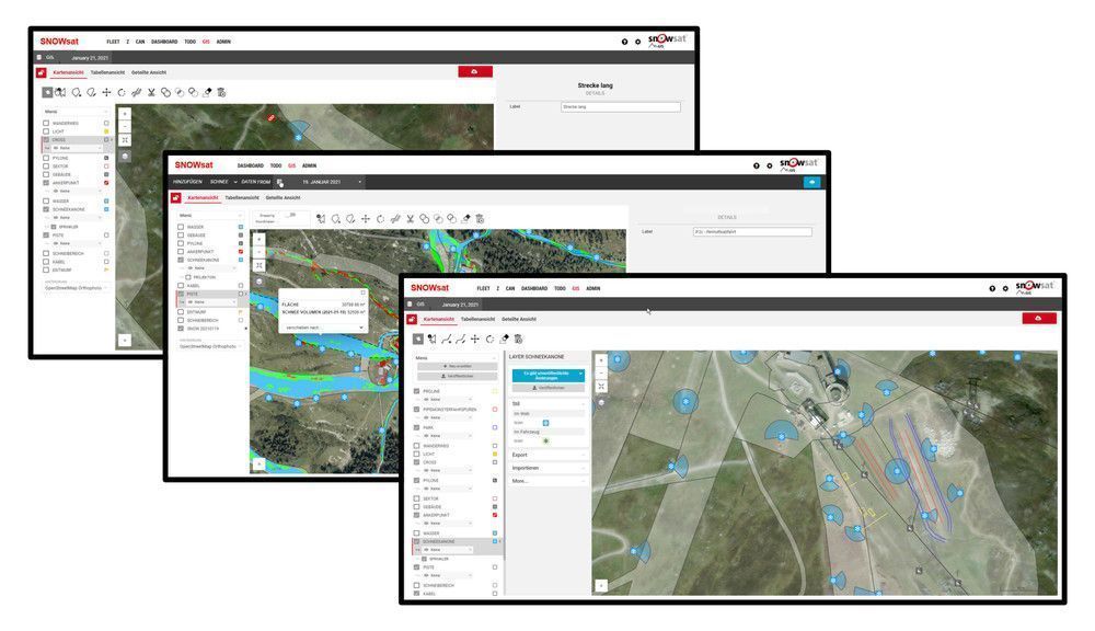
The SnowSat GIS Data Manager is a solution for managing the GIS data in the ski area. Data points are either added manually or recorded using the snow groomer. Geo data recorded with a mobile device (e.g. survey stick) can also be imported. Vehicles equipped with SnowSat are capable of recording anchor points or positions of snowguns, for example. In addition, they can follow slope edges. The user can then adapt the existing slope edges to the recorded driving paths using the software and thus update them. An accurate map of the entire ski area is created that is automatically available not only in the office but also in all snow groomers.
Efficient together
The SnowSat GIS Data Manager supports coordination between teams as all responsible persons have access to the data. This not only increases efficiency in the ski area but also reveals new opportunities for saving money. A true all-in-one solution!
Your indispensable tool – the SnowSat GIS Data Manager at a glance
- Central management of all geodata
- Individual and flexible adaptation of data to current conditions - independent of the surveyor
- Cost saving (saving of surveyor)
- Data basis for further calculations (specific evaluation of vehicle use, expenditure for slope operation)
- Always up-to-date digital image of the ski area
- Less complexity: focus on the necessary functions
- (Fast) reproducibility of events and attractions
- Uniform knowledge and information base for all in the team
- Increase of safety (for decisions of the responsible persons and for the work of the drivers: Marking of danger spots, Auxiliary lines, orientation points
