Revolution of snow depth measurement
The predictive snow depth measurement is in the starting blocks
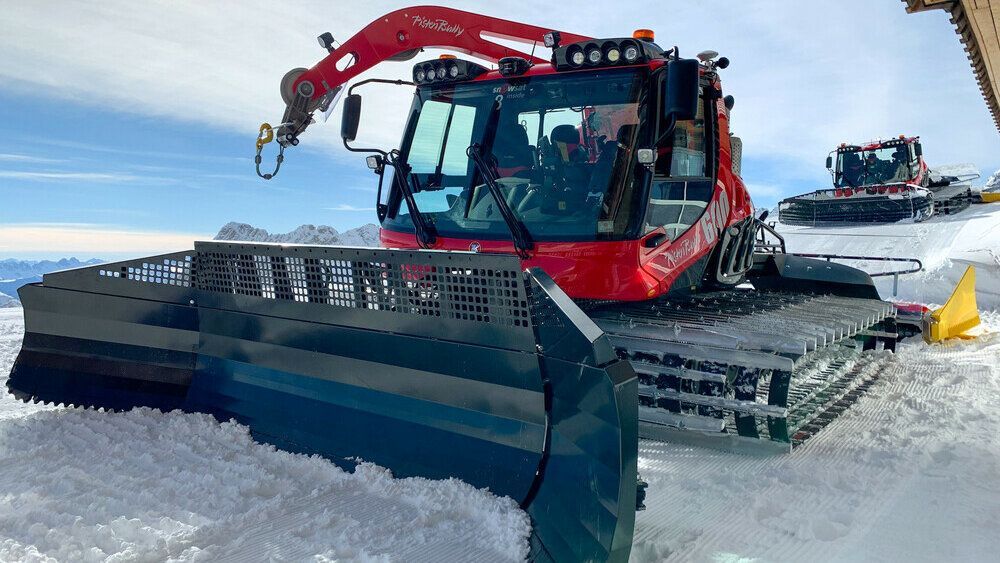
The first LiDAR system on the Zugspitze has been in operation since the beginning of 2021.
The presentation of predictive snow depth measurement with LiDAR technology, a SnowSat world first, caused a sensation at Interalpin 2019. Measuring snow depth 30 to 50 meters in front of the vehicles is revolutionary. And now, the first systems are being used by customers. There they are being put through their paces. The first impression: SnowSat LiDAR is the future!
In use on the Zugspitze
The Zugspitze ski resort is one of the first areas to use predictive snow depth measurement. The LiDAR system has been installed there for several weeks. The laser scans the terrain in front of and next to the vehicle at a 120° angle with 200,000 points per second. Up to 2,600 square meters can be covered in real time. Stefan Piehler, head of SnowSat software development, has been in close contact with the customer from the very beginning. Together with the customer, it is examined how, for example, different visibility and weather conditions affect the measurement performance. The evaluation of the measurement data and the continuous exchange with the users are fundamental to further optimize the LiDAR system, including the new operating concept of the vehicle software.
The first conclusion: "A quantum leap" in snow depth measurement
Due to the current situation, regular operations are currently not taking place at Zugspitze, as in all German ski resorts. The team is using the time this spring to prepare snow caches for the coming season. The predictive snow depth measurement system is being put to full use here. Martin Hurm, operations manager at Bayerische Zugspitzbahn Bergbahn AG, is enthusiastic: "My expectations of the predictive snow depth measurement have already been exceeded. The fact that we know the snow depth data far in front of the vehicle and to the side of the vehicle helps us when creating snow caches and pushing in runs. That's a quantum leap!"
Seeing the future
The first uses of the predictive snow depth measurement make us want to do more: thanks to SnowSat LiDAR, drivers can detect low-snow areas from a distance and react accordingly at an early stage. By scanning the area next to the vehicle, drivers often save themselves many passes. At the same time, ski resorts gain valuable, up-to-date data through SnowSat LiDAR, which is the basis for economic decisions, among other things. The coming summer will be used to intensively evaluate all measurement data and fine-tune the software. And then we are looking forward to the feedback next winter!
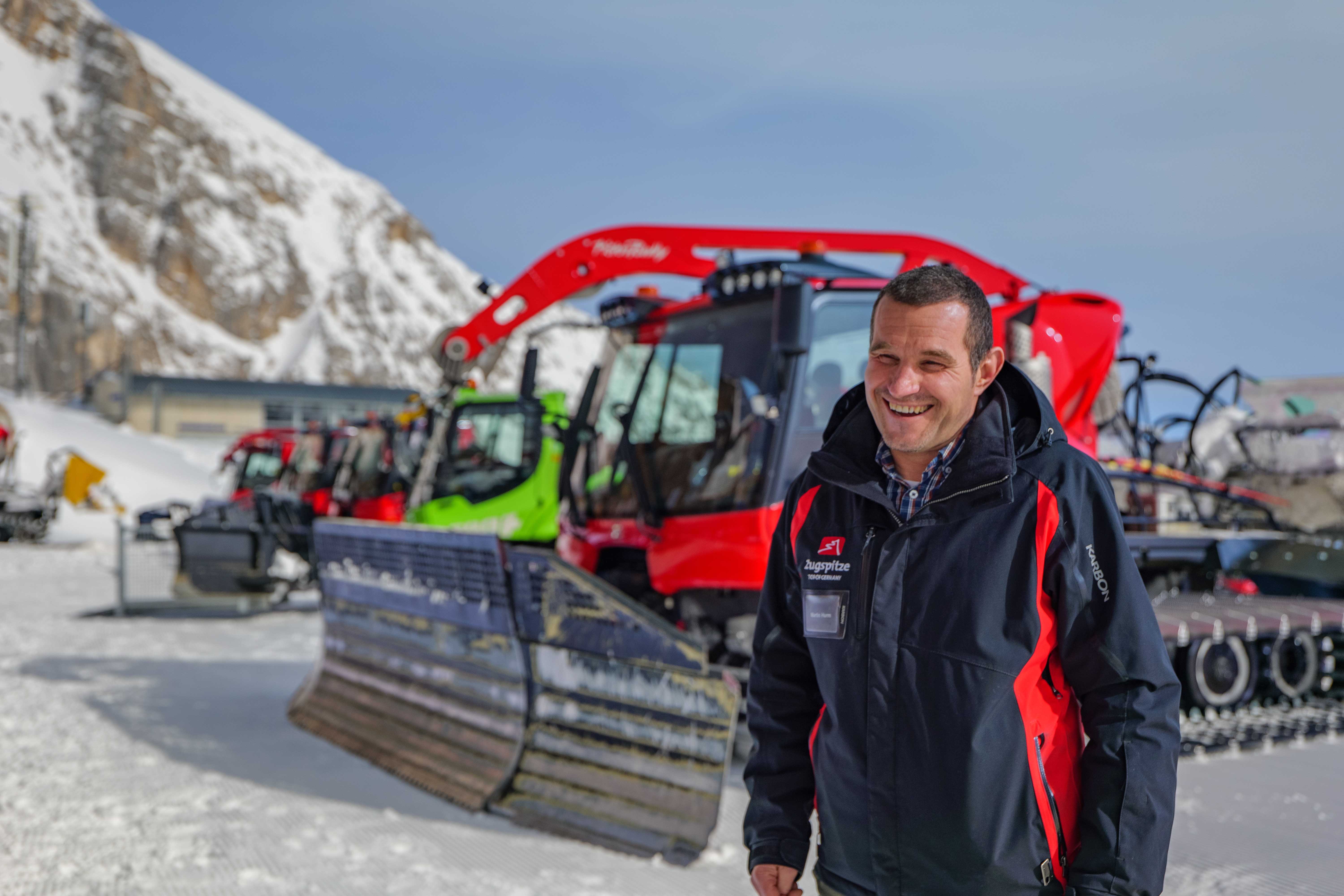
The fact that we know the snow depth data far in front of the vehicle and to the side of the vehicle helps us when creating snow caches and pushing in runs. That's a quantum leap!

The LiDAR sensor on the driver's cab scans the terrain at a 120° angle 30 m to 50 m in front of the vehicle in real time. 200,000 data points are processed per second.

Small component with big impact - SnowSat LiDAR revolutionizes snow depth measurement
